June 30, 1975 - Yellowstone National Park, WY - M 6.1
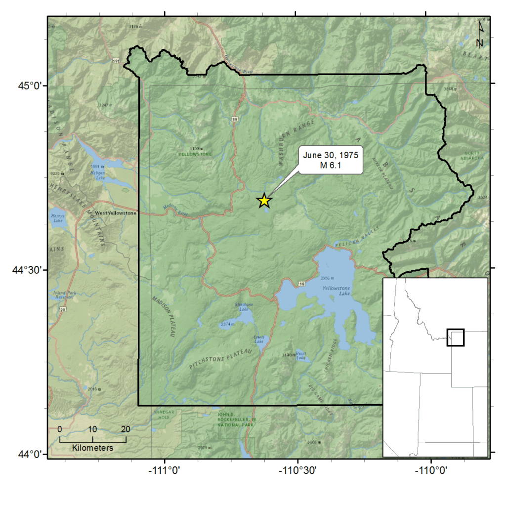
This earthquake was located approximately 5 miles ESE of Norris Junction, in Yellowstone National Park. According to newspaper accounts, no casualties resulted from the earthquake and damage was minor. Near the epicenter, telephone service was temporarily knocked out. The earthquake also dislodged boulders that temporarily blocked a road between Norris and Madison Junction – however, campgrounds and park facilities remained open.
A park service employee reported, “There wasn’t any noise; no dishes rattled. There was just a gentle rolling of the floor.”
The earthquake shook buildings and rattled windows 200 miles away from the epicenter, and was reported felt both in Great Falls and Billings, Montana. The total felt area of the earthquake was 50,000 square kilometers.
A significant aftershock (magnitude 5.5) occurred just over 17 months later on December 8, 1976, approximately 5 miles W of Norris Junction. This earthquake was the largest since the June 30, 1975 main shock, and was felt over an area of 5,000 square kilometers.
Park officials noted that the aftershock shook buildings, but no damage was reported. One park official believed that damage to the terrain would likely be limited to rockslides. The earthquake occurred after the close of the summer tourist season – the park service received no inquiries about the earthquake from individuals inside park boundaries.
For additional information about this earthquake:
Earthquake Summary Newspaper Articles Additional Resources