June 27, 1925 - Clarkston Valley, MT - M 6¾
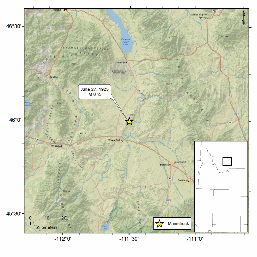
The Clarkston Valley, Montana earthquake occurred at 6:21 p.m. local time on June 27, 1925. The epicenter was located approximately 8 miles north of Three Forks, MT just north of Yellowstone Park. It was reported felt over nearly two-thirds of the state (approximately 1,000,000 square kilometers) – as far west as Seattle, WA to the eastern Montana/South Dakota border, as far north as Thermopolis and Casper, WY and south to Spokane, WA.
Some buildings in areas near the epicenter were badly damaged. Buildings and pavement were cracked. Chimneys toppled. Windows shattered in some locations. Plaster was shaken from walls and merchandise fell from store shelves.
The heaviest damage in terms of quantity and severity was reported in Three Forks, Manhattan and White Sulphur Springs with some buildings being reduced to rubble. There were also reports of extensive damage to the town of Willow Creek, including reports that the town was in flames. Broken wire connections prevented communication to confirm these reports. It was later learned that damage in Willow Creek was slight.
Some individuals rushed into the streets, fainted or were knocked to the ground from the shaking, but no loss of life was reported. A woman sustained a broken leg (also reported as a broken hip) as she fell while rushing out of her home. Additional reported injuries were limited to bruises and cuts due to broken glass and falling materials. Many individuals were too nervous to sleep and some preferred to sleep out of doors.
The earthquake triggered several landslides and rockslides. Three passenger trains were stranded when rockslides blocked rail lines. There were also reports of rail tunnels caving in. And some concern was reported about the safety of area bridges. A number of ground cracks and fissures were reported in areas closest to the epicenter. There were also reports of increased flow at some springs in the area.
It was reported that the day following the earthquake, thousands of visitors from nearby towns and cities flooded into Manhattan and Three Forks to survey the damage.
For additional information about this earthquake:
Earthquake Summary Newspaper Articles Photos Additional Resources